Bible Atlas: What It Does and How To Use it
A Bible Atlas is an often overlooked but extremely valuable Bible study resource. A good Bible atlas can enhance your understanding of the geographical background of a passage of Scripture and really make the story come alive for you.
A Bible atlas is a resource that provides maps and illustrations to help readers explore and experience locations mentioned in the Bible. A Bible atlas is a simple to use resource that can enhance one’s understanding of the historical and geographical context, making visualizing the setting easier.
Sound intriguing? Then let’s explore the contents of a Bible atlas as we discover exactly how valuable and useful they really are in Bible study.
Disclaimer: This post may contain affiliate links that at no additional cost to you, I may earn a small commission. Read full privacy policy here.
Contents Of A Bible Atlas
Overall, a Bible atlas includes information and maps on various topics related to the history, geography, and archeology of the Bible, the land of Israel, and the surrounding nations. Here are some common contents and features that you can find in a Bible atlas.
Maps
Maps provide detailed geographical representations of Biblical places with key cities and locations labeled. They can depict things like boundaries of historic empires or possible travel routes of Biblical figures.
Geography plays an important role in the life of the people in Bible times. For example, the Bible always talks about going up to Jerusalem, whether you are coming from the north or the south. This is because Jerusalem is on a mountain. A Bible atlas can help you see that.
Historical and Cultural Context
A Bible atlas also includes historical, cultural, and political contexts of specific Bible periods. As such, a Bible atlas is more than just a book of maps. It provides a resource for understanding the historical and cultural background of the events of the Bible.
For example, the Bible atlas I have includes a section titled the “Egyptian Experience.” This section discusses things like the history of Egypt prior to the Exodus, as well as what life in Egypt looked like.
Archeological Sites
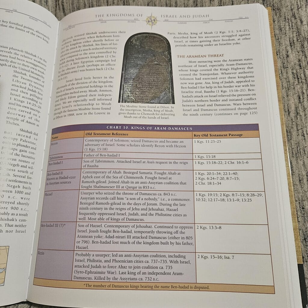
A Bible atlas will highlight key archeological discoveries and sites related to the land and history of the Bible. Often they will highlight how the discoveries have impacted our understanding of Bible history. This provides physical archeological evidence that supports the history and truth of the Bible stories.
Timelines
Timelines in a Bible atlas provide a chronological representation of events and people in the Bible. They are useful in tracking the progression of events and knowing what other events may have been going on at the same time.
For example, we can discover that Paul’s 2nd missionary journey occurred while Claudius was Emperor, but his third missionary journey occurred when Nero was Emperor. It was under Nero that both Paul and Peter were martyred.
Illustrations
The illustrations in a Bible atlas provide visual pictures of artifacts, structures, and scenes. It is these illustrations that can really help the Bible come alive when you are studying it.
For example, you can see an illustration of what Jerusalem would have looked like at the time of Jesus right alongside an image of the remains of the pool of Bethesda outside of the temple. This really helps you create a mental image of Jesus healing the lame man by the pool.
Topographical Detail
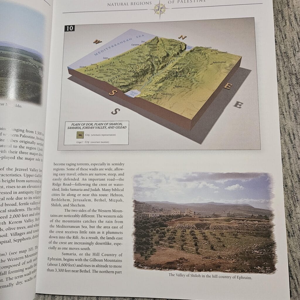
Bible atlases also contain information on the terrain and climate of the Biblical lands, this helps readers better understand the travel and living conditions of the people in the Bible.
This topographical detail may include things like a calendar of the rainy seasons or the climate and temperature of various regions throughout the middle east. This is helpful in understanding how the geography influenced the lives and travel of people in Bible times.
The Accuracy of Bible Atlases
While the features of a Bible atlas are vast, the accuracy of those features is vital. This is especially true if you are considering getting a Bible atlas for Bible study.
The accuracy of a Bible atlas can depend on a number of factors, including,
- level of scholarly research
- updated information
- use of citations and sources
- denominational or theological influence
- accuracy of maps and illustrations
As a general rule, more recent Bible atlases published by well known scholars or leading Christian publishers are going to be the most accurate. Typically, accurate atlases are also going to be more widely used.
So, if you are concerned about the accuracy of an atlas, then read reviews or seek input from your pastor or Christian community.
But in general, Bible atlases will reflect the most recent scholarly consensus and understanding of the Bible and geographical locations.
The Value of A Bible Atlas
A Bible atlas brings great value to Bible study. Why? Because a Bible atlas gives you the geographic and historic information you need to help the Bible come alive in your mind as you read it.
You are able to visualize the setting of biblical events and enter the story yourself. In short, you learn to experience the Bible.
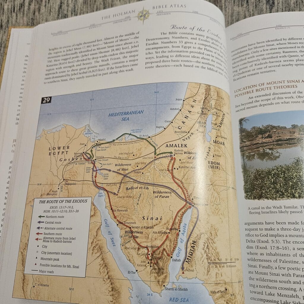
For example, I have been reading a lot about the Exodus and the route of the Israelites took out of Egypt. The Bible lists so many different places where they stopped. To me, it was just a bunch of random names of places I knew nothing about.
But using a Bible atlas, I am able to see a map of possible routes of the Exodus and the location of where these place names are. I also got to read about the route in detail and see how even though we may not know exactly where some of these places are we can get a general idea.
Now, anytime I read the Exodus story I can picture the map in my mind and the story becomes clearer and more alive.
Using A Bible Atlas In Bible Study
I’m sure you’ve begun to see that a Bible atlas can be a great benefit to a wide variety of users. It is a versatile Bible study resource that can serve personal as well as educational purposes. Here are some ways that a Bible atlas can be used.
Uses of A Bible Atlas
- Biblical Study and Research: A Bible atlas can be used to explore the geographical context of specific Bible stories, enhancing your understanding of the text.
- Sermon Preparation: Pastors can use a Bible atlas for sermon preparation, by not only exploring the geographical context of a passage, but also as a visual aid to help teach that context during a sermon.
- Sunday School: Like sermon preparation, a Bible atlas can be a useful tool for a visual aid in teaching or preparing a Sunday School lesson. A Bible atlas, can make your Sunday School classes more interesting.
- Personal Devotion: A Bible atlas can also be used at home for personal devotion. It’s amazing how much understanding the geographical context of a passage makes the Bible come alive. As a result, our practical and devotional relationship with God and the Bible deepens.
- Historical and Cultural Setting: A Bible atlas is immensely helpful in understanding the historical and cultural context behind a passage of Scripture. Understanding these contexts can be essential in building a good Bible study habit.
- Travel Planning: Honestly, this one is just for fun. But a Bible atlas can be helpful if you are wanting to visit the Holy Land or the Middle East. You can discover and learn more about the places that are “must see” for you.
Using A Bible Atlas
A Bible atlas is simple to use. Simply refer to the maps and corresponding information for the places you want to know more about. Here is a brief step-by-step guide to getting the most out of your Bible atlas:
- Select a reliable and accurate atlas.
- Choose the place or event you want to know more about from the Bible passage you are studying.
- Use the index in the Bible atlas to find the name of the place or event you are interested in.
- Go to those pages and look at the maps, illustrations, charts, and read the surrounding and relating commentary.
Honestly, the key is to use the index. The index in the back of the Bible atlas will make learning more about particular places or events easier. Why? Because it will tell you exactly what pages to turn to related to what you are exploring.
Best Bible Atlases
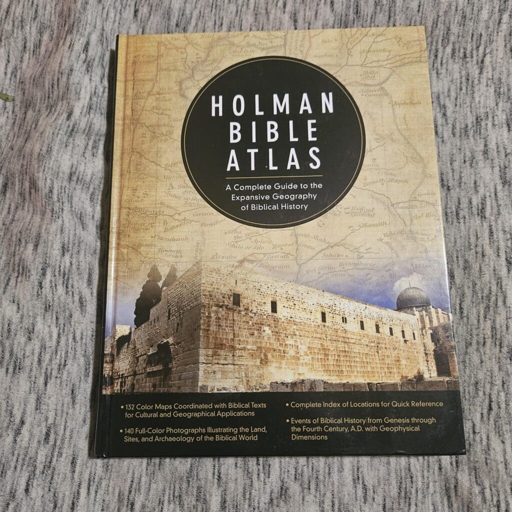
The Holman Bible Atlas is one of the leading and award winning Bible atlases available today. It is a comprehensive resource that boasts over 132 maps and over 100 illustrations and photos.
The Holman Bible Atlas offers a clear understanding of the Biblical world, making it a valuable tool for scholars and lay people. It provides ample historical and geographical context to the stories of the Bible. I have the Holman Bible Atlas and thoroughly enjoy it, but sometimes wish there was more maps.
The Zondervan Atlas of the Bible is another award winning Bible atlas. As such, it is similar to the Holman Bible atlas. What makes it unique is features like its use of multidimensional and 3D maps, and its comprehensive listing of place names in the Bible.
Overall, the Zondervan Atlas of the Bible covers a wide range of historical and geographical information, making it a great resource for beginners in Bible study. Also, it was created by Carl Rasmussen, who has first hand experience living and teaching in the middle east.
Rose Book of Bible Charts, Maps, and Timelines
The Rose Book of Bible Charts, Maps, and Timelines is a great resource for beginners in Bible study. In fact, it is one of the first Bible atlases I got when I started learning to study the Bible.
It is full of information like then-and-now maps, and charts on a variety of topics like Jesus’ ministry, Psalms 23, the twelve tribes of Israel and so much more. Honestly, if you are a visual learner then this will quickly become a go to user-friendly resource.
I love the Rose Book and all the information it provides, but it can still feel overwhelming at times.
The New Moody Bible Atlas is a scholarly work that blends historical research, maps, and illustrations. As such, it is geared more toward serious Bible students, pastors, and educators, than beginners in Bibile study.
That said, this Atlas has amazingly helpful and detailed maps. I have found these maps often provide more of the detail that I want than other atlases. These are the most unique maps I have seen in a Bible atlas.
The ESV Bible Altas is designed to partner with the ESV translation of the Bible. The maps of the ESV BIble atlas advanced satellite imaging technology, making the maps really pop.
Moreover, I found the ESV Bible Atlas to be easy to read and follow along. What makes this Atlas unique is that it includes a CD-ROM or Password to access digital maps. Overall, the ESV Bible Atlas is a study tool, its full of information and perfect for students of the Bible or fans of the ESV.
Honestly, all of these Bible atlases are top notch. So, I have a hard time choosing just one to recommend. You can’t go wrong with any of these Bible Atlases. All of them will aid your understanding of the historical and geographical context of the Bible and make the stories of the Bible come alive as you study.